Sea and outdoors
Walks and hikes in and around Brindisi
Quick answer
The best walks around Brindisi are easy and flat: a 4 to 5 km loop of the old town and harbour, the lake paths of the Parco del Cillarese on the edge of the city, the salt marshes of Punta della Contessa for birds and flamingos in winter, the cork-oak woods of Santa Teresa and the Lucci, and the dune and wetland paths of Torre Guaceto.
| Terrain | Flat everywhere, no real climbs |
|---|---|
| Old town loop | About 4 to 5 km, 2 to 3 hours with stops |
| Parco del Cillarese | About 170 hectares, open about 6:00 to 22:30 |
| Punta della Contessa | About 214 hectares of wetland, south of the city |
| Torre Guaceto walk | About 1.5 km guided route to the tower, easy |
| Best months | October to May; summer only at dawn or dusk |
Where can you walk and hike around Brindisi?
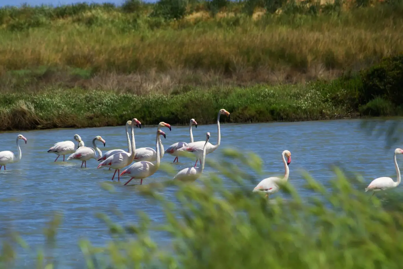
On a clear January morning at Punta della Contessa, the only sounds are wind in the reeds and, now and then, a strange honking from the water. Then you see them: a line of flamingos, pink against grey water, a few kilometres from a city of eighty thousand people. Nobody else is there.
Brindisi is not mountain country. The land around it is flat, and nobody comes here for summits. What it has is variety within half an hour: a walkable old town on the water, a city park around a lake, coastal wetlands full of birds, the last cork-oak woods on this side of Italy, and a protected coast with dunes and a watchtower. The walks are short and easy, which makes them perfect for a rest day between day trips, for families, and for anyone who wants nature without crowds.
A note on seasons before we start: from mid-June to early September there is little shade and the sun is fierce. Walk early, carry water, and keep the longer routes for spring, autumn and winter, when this coast is at its best.
A walking route through Brindisi old town
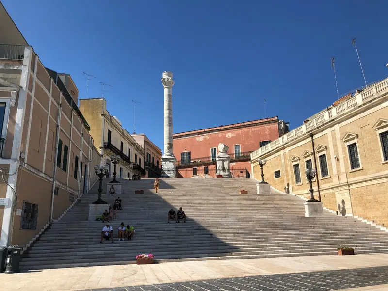
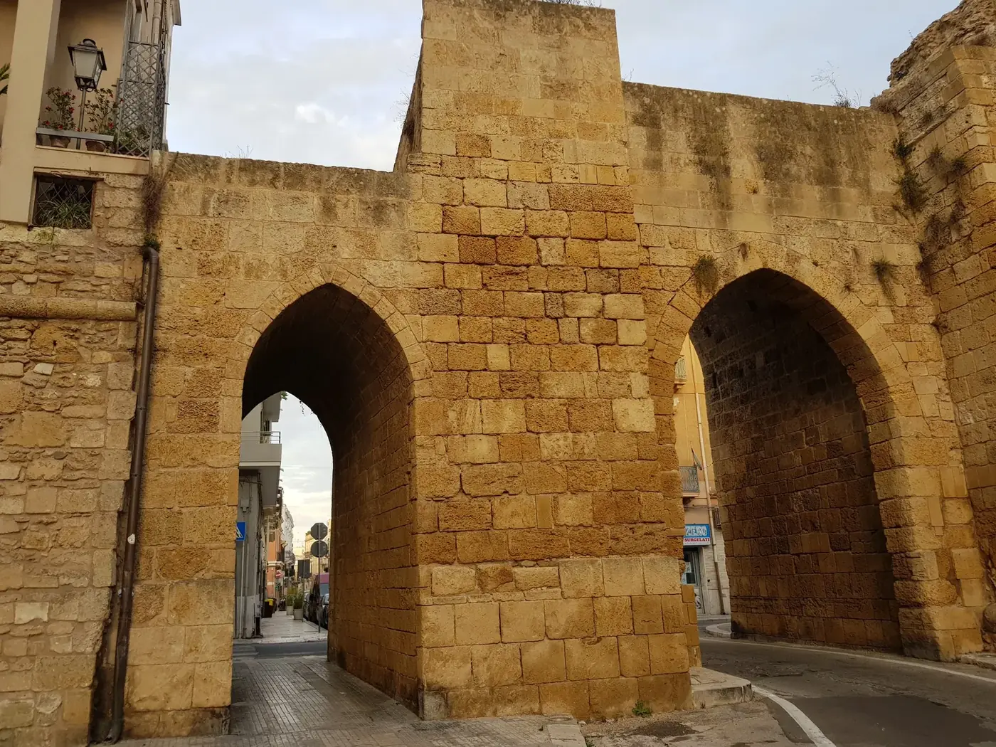
Start at the Roman column above the harbour, the traditional end of the Via Appia, and go down the steps to the waterfront, Lungomare Regina Margherita. Walk along the water, then turn up into the old town to Piazza Duomo, with the cathedral and the Portico dei Templari. Continue to the round church of San Giovanni al Sepolcro, then through the lanes to Porta Mesagne, the old gate on the road inland, where the ancient Appia entered the city. Come back along Corso Garibaldi to the water.
That loop is about 4 to 5 km and takes two to three hours with stops. Add the boat across the harbour to the Monumento al Marinaio for the best view back over the town. From the monument it is about 2 km on foot through the Casale district to Santa Maria del Casale, a Romanesque-Gothic church with fine frescoes, which makes a good extension on a cool day. For the history behind each stop, read our history of Brindisi guide.
Parco del Cillarese: the city's lake park
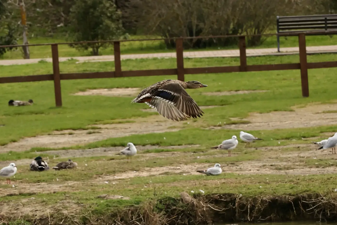
The Parco del Cillarese is the city's green lung, about 170 hectares on the western edge of Brindisi, along the road towards San Vito dei Normanni. At its centre is an artificial reservoir that has become a habitat for water birds, both residents and winter visitors. Paths run around the water and through the trees, and locals use it for running, cycling and evening walks. The city's tourism site gives opening hours of about 6:00 to 22:30.
It is the easiest nature walk in town: no car needed if you are happy with a longer walk or a short taxi, flat paths, and enough birdlife to keep children interested. The park also sits on the line of ancient roads leaving the city, and it is often the end point of rides during Appia Day in early October.
Punta della Contessa salt marshes: flamingos and quiet beaches
South-east of the city, the Parco Naturale Regionale Saline di Punta della Contessa protects about 214 hectares of coastal wetland: freshwater ponds that flood with seawater in storms, salt marsh, reeds and long empty beaches. It is a special protection area for birds, and in winter it is one of the places in Puglia where you can see flamingos, along with herons, egrets and many waders.
There is no visitor centre or marked circuit to speak of. You walk along the dirt tracks and the shore, so wear proper shoes, take binoculars and water, and expect to see more birds than people. The area is about 20 minutes by car from the old town. The industrial chimneys of the coast further south are part of the view, which surprises some visitors, but the birds do not seem to mind.
Bosco di Santa Teresa e dei Lucci: the cork-oak woods
Inland, between Brindisi, Tuturano and Mesagne, the Riserva Naturale Regionale Orientata Boschi di Santa Teresa e dei Lucci protects what is left of a great cork-oak forest. The cork oak is a rarity on Italy's Adriatic side, and walking under these trees, with strawberry trees, myrtle and heather below, feels nothing like the open olive country around them. Badgers, tree frogs and nightjars live here.
The reserve is made of separate small woods, and parts are privately owned, so it is not a place for a long free hike. The best way in is a guided walk or an organised ride: the local cycling association Cicloamici, for example, runs family rides from Mesagne to the Bosco Preti along quiet roads that follow the line of the Via Appia, about 16 km in total. Spring, when the undergrowth flowers, is the best time.
Torre Guaceto: dunes, wetlands and the watchtower
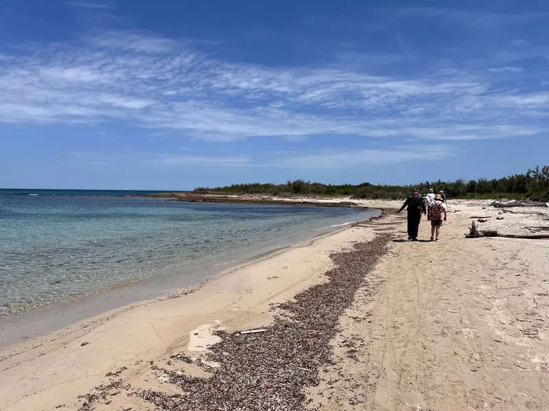
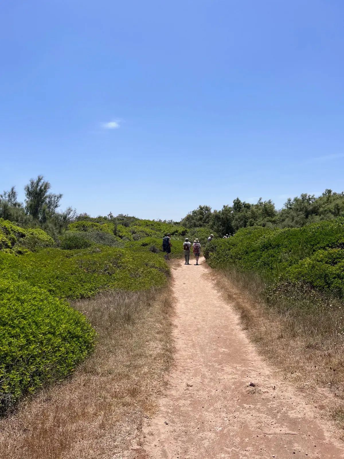
The most beautiful walking near Brindisi is at Torre Guaceto, the reserve about 25 minutes north. Paths cross dunes covered in juniper, a wetland of reeds fed by freshwater springs, and small coves, ending at the 16th-century Aragonese tower on its headland.
The reserve's guided walk, Sulla via della Torre, run by the Cooperativa Thalassia, is about 1.5 km on sand and earth, takes about two and a half hours with stops, is rated easy, and is described as suitable all year and for children from about three. It starts at the Al Gawsit visitor centre in Serranova. In summer you can stop for a swim on the way. You can also walk the shore from the beach car parks, but stay on marked paths: the dunes are fragile, and some areas are closed to protect nesting birds.
Coastal walks and the last stage of the Via Appia
North of the city, the coast between Punta Penne, Apani and the edge of Torre Guaceto is low rock broken by small sandy coves. Outside summer you can walk long stretches along the shore, from cove to cove, with the sea on one side and fields on the other. Check the tide line and the wind: with a strong north-westerly the waves cover the rocks.
For a walk with a goal, try the final stage of the Cammino dell'Appia, the walking route that follows the Via Appia from Rome: Mesagne to Brindisi is about 16 km, flat, partly on country lanes and partly on city pavements, ending at the Roman column. Take a train or bus to Mesagne and walk back. Our guide to the Via Appia and Via Francigena in Brindisi explains the stages.
Comparing the walks: distance, difficulty and season
| Walk | From the old town | Length | Difficulty | Best season |
|---|---|---|---|---|
| Old town and harbour loop | On foot | 4 to 5 km | Easy | All year, early or late in summer |
| Monumento to Santa Maria del Casale | Harbour boat | About 2 km each way | Easy | October to May |
| Parco del Cillarese | Taxi or a long walk | Loops of 2 to 5 km | Easy | All year |
| Punta della Contessa | About 20 minutes by car | Free route, 3 to 6 km | Easy, unmarked | November to March for flamingos |
| Boschi di Santa Teresa e dei Lucci | About 20 to 25 minutes by car | Short walks or a 16 km ride | Easy, best guided | March to May, October |
| Torre Guaceto tower walk | About 25 minutes by car | About 1.5 km | Easy | All year |
| Mesagne to Brindisi (Via Appia) | Train or bus to Mesagne | About 16 km | Moderate for length | October to April |
None of these needs hiking boots, but trainers with grip are better than sandals on the coast paths. For walks with children, see our Brindisi with kids guide.
Where to stay for walking days
Staying in the old town means the first walk starts at the door: the Roman column is a few minutes away, and you can be at the harbour boat before breakfast. For the reserves you need a car or a lift; there is free parking in Via Spalato, about 9 minutes on foot from BDS House.
Our house sleeps up to six, has a full kitchen for packing picnics, a washing machine for muddy socks and two terraces for stretching tired legs at sunset. The airport is about 10 minutes away, so a last walk on the morning of departure is realistic. You can check dates and book here, and see our best time to visit guide to pick the right season.
Questions travellers ask
Are there hiking trails near Brindisi?
Yes, but they are walks rather than mountain hikes. The best are at Torre Guaceto nature reserve, the Punta della Contessa salt marshes, the cork-oak woods of Santa Teresa and the Lucci, and the Parco del Cillarese. All are flat and easy, and most are within 25 minutes of the old town.
Where can I see flamingos near Brindisi?
At the Punta della Contessa salt marshes, a regional nature park on the coast south-east of Brindisi, about 20 minutes by car. Flamingos are seen mainly in the cooler months, from late autumn to early spring. There are no facilities, so bring binoculars, water and good shoes.
How long is the walk at Torre Guaceto?
The reserve's guided walk to the Aragonese tower is about 1.5 km and takes about two and a half hours with stops, on sand and compacted earth with no climbs. It starts at the Al Gawsit visitor centre in Serranova and is suitable for children from about three years old.
Is Brindisi old town walkable?
Yes, completely. A loop from the Roman column along the waterfront, up to Piazza Duomo, San Giovanni al Sepolcro and Porta Mesagne and back is about 4 to 5 km. Most sights are within a 15-minute walk of each other, and the streets are flat.
What is the Parco del Cillarese?
It is Brindisi's main city park, about 170 hectares around an artificial reservoir on the western edge of town. The lake attracts water birds, and paths around it are used for walking, running and cycling. It is open from early morning to late evening.
Can you walk the Via Appia from Mesagne to Brindisi?
Yes. The last stage of the Cammino dell'Appia, from Mesagne to Brindisi, is about 16 km and flat, on country lanes and city streets, and ends at the Roman column. Go to Mesagne by train or bus and walk back. Avoid the hottest hours in summer.
When is the best time for walking in Brindisi?
From October to May. Spring brings flowers in the woods and dunes, autumn is warm with clear light, and winter is mild and the best season for birds at the salt marshes. In summer, walk only in the first hours after sunrise or around sunset.
Do I need a car for walks near Brindisi?
For the old town and the Cillarese park, no. For Torre Guaceto, Punta della Contessa and the cork-oak woods, a car or a taxi is much easier, as public transport is limited. Guided tours sometimes include transport, so ask when booking.
Sources and further reading
- Torre Guaceto: Al Gawsit visitor centre
- SeaBrindisi: Saline di Punta della Contessa park
- SeaBrindisi: Parco del Cillarese
- Brindisiweb: Boschi di Santa Teresa e dei Lucci
Times and prices are approximate and change by season. Last checked on 3 October 2026.